
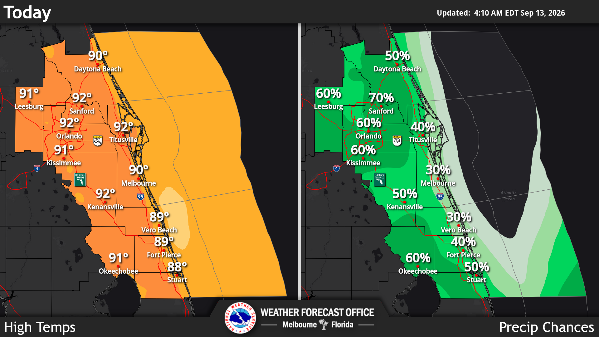
Muggy conditions began the day Sunday across Central Florida with rising temperatures and a chance for thunderstorms again, according to the National Weather Service in Melbourne.
Read more ‘Not fully investigated’: Where the Hope Florida grand jury didn’t look
The primary storm threat remains heavy downpours and the potential for minor flooding in slow-moving storms.
Temperatures will quickly climb into the 80s and afternoon highs mostly reach the low 90s today. NWS reported peak heat index values reach the low triple digits again, ranging from 100 to 106 degrees.
Frequent lightning and localized wind gusts of 40-50 mph could accompany any stronger storms. Light to moderate showers and occasional lightning strikes will likely linger beyond sunset, mostly drying by 10 p.m., forecasters said.
A sea breeze collision is expected just east of the Orlando Metro area, where the greatest coverage of showers and storms should occur late in the afternoon and into the evening.
Read more Could the ‘STAR Plan’ bring mass transit to Orange County?
Forecasters reported that a moderate risk for rip currents continues at Central Florida’s east coast beaches, expressing the urgency of always swimming near a lifeguard and never alone.
Looking ahead, a pattern of sea breeze-focused showers and storms continues early this week. Breezier conditions with additional rounds of onshore moving showers and storms are foreseen in early and midweek, the NWS stated.
Anticipated rounds of showers and occasional storms in coastal locations should generally continue each night, though temperatures return closer to normal by the middle and latter part of next week, forecasters said.
Read more DeLand historian searches for a permanent home for storied WWII tugboat ‘Tiger’