
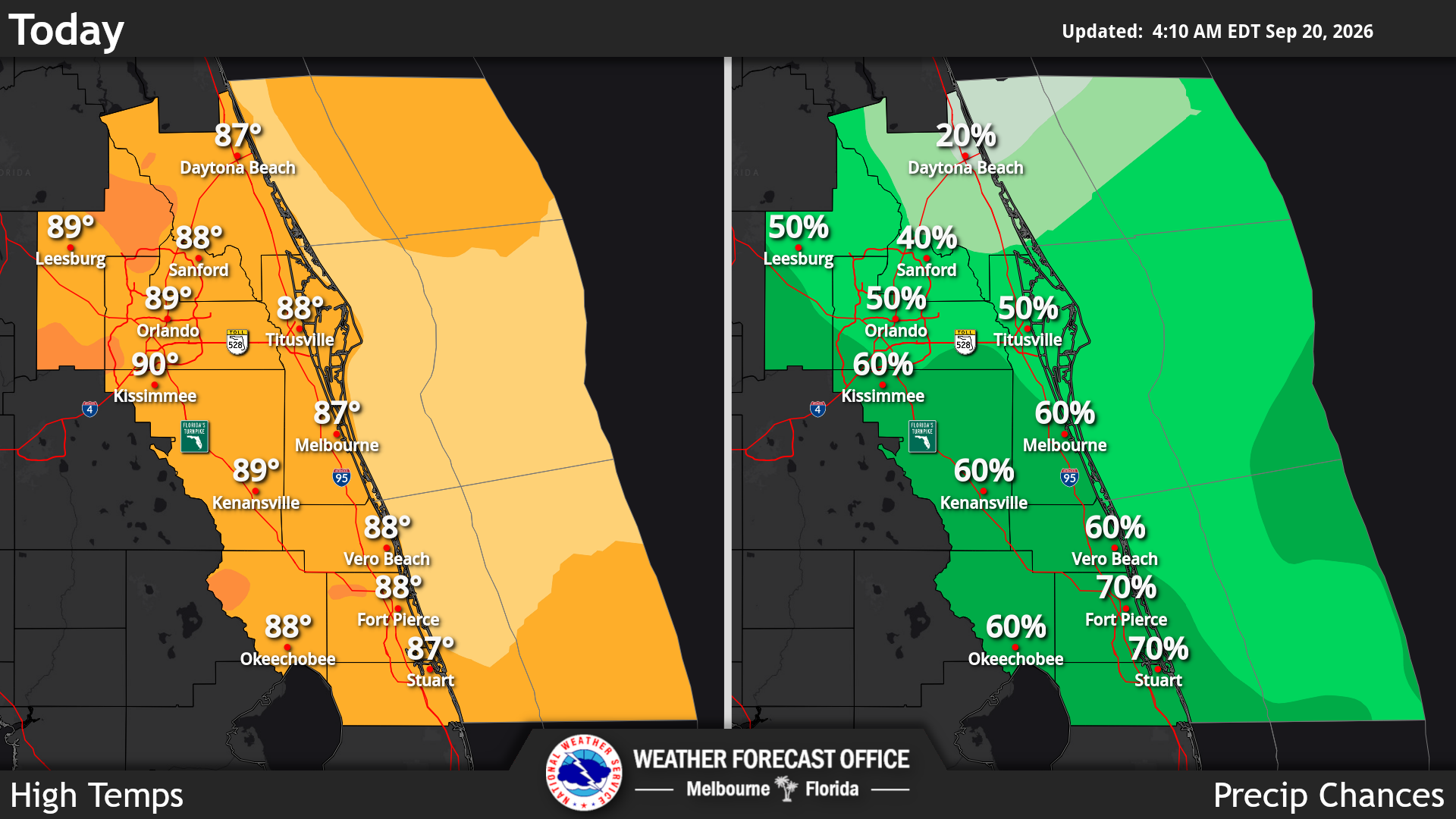
Cool temperatures overhead will support a possible few strong storms containing frequent lightning strikes, gusty winds up to 50 mph, small hail and locally heavy rainfall of 1 to 3 inches, according to the National Weather Service in Melbourne.
Read more Decades after fleeing the Nazis, a Florida survivor’s family is honored in Berlin
The NWS is expecting rain chances to reach 50-70% along the coast south of the Cape and over the interior, with the lowest rain chances along the Volusia coast at 20-40%. Scattered showers and isolated storms over the Atlantic this morning will cross portions of the coast in a light onshore flow.
Showers and storms are said to shift back over the Atlantic waters tonight, with some activity brushing the coast. Seasonably warm temperatures with highs in the upper 80s to near 90s are in store with peak heat indices in the mid to upper 90s, forecasters said.
Looking ahead, forecasters anticipate that the upper-level low off the west coast of Florida will start the week, slowly filling and lifting northeast.
Read more Guest Commentary: Jolly shows he cares about disability services
Deep moisture will remain through midweek locally, supporting high rain and storm chances, with a 60-70% chance of rain through Wednesday. A cool front is forecast to cross the area Thursday with lower rain chances and slight cooling later in the week.
Slightly drier air will filter across the local area into late week behind a frontal passage, resulting in rain chances becoming near-normal at 30-50% on Friday into the weekend.
Main storm hazards continue to be frequent lightning strikes, gusty winds around 45 mph and locally heavy rainfall. Seasonable temperatures are forecast, with highs in the upper 80s to low 90s through midweek, then lowering somewhat into the mid-to-upper 80s behind the front from Friday to Saturday.
Read more 6 shot, 2 in critical condition, at Sanford family gathering