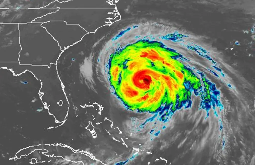
For weeks, weather experts have predicted a “below-average” 2026 Atlantic hurricane season beginning Monday, with a total of 13 named storms.
Read more 2026 Florida Prize in Contemporary Art weaves global cultures and ideas
But emergency management officials across Central Florida fear the somewhat sunny forecast may lead residents to develop a sense of complacency — especially after last season, when not a single tropical storm or hurricane struck the state.
“I don’t care what they say when I look at predictions,” said Carlos Durden, Orange County’s new director of the office of emergency management. “We are always reviewing plans. We are constantly doing exercises and computer checks. We are reaching out to the community…Because all it takes is one [storm].”
Also a concern is a new Trump administration policy in which FEMA, the Federal Emergency Management Agency, is limiting its spending to only the most urgent, life-saving needs during catastrophic disasters.
“We’ll be told, ‘Florida, use your own money’” to respond and recover from a disaster, said Dennis Smith, director of the Mark and Marianne Barneby Planning and Development Lab at FSU. “We’re going to see more state responsibility.”
On average, a hurricane season — which runs from June 1 through Nov. 30 — sees about 14 named storms, including seven hurricanes, three of which are major ones with winds of at least 111 mph.
But in their annual preseason storm outlook this month, researchers at Colorado State University predicted six hurricanes, two of which will be major. Forecaster AccuWeather also is calling for a slower-than-average hurricane season, as is the National Oceanic and Atmospheric Administration in their forecast released last week.
One of the reasons for the brighter forecasts is the weather bully known as El Niño, which means little boy or Christ child in Spanish. The pattern creates more widespread wind shear and sinking air across the Atlantic basin, which tend to break up developing storms.
Early signs also show this isn’t a run-of-the-mill El Niño, with the ocean surface waters in the Pacific forecast to be nearly three degrees warmer than normal. That raises the chances of a so-called Super El Niño this year, meaning fewer tropical storms in the Atlantic on average but more rain and stormy weather during the fall and early winter.
Regardless, Central Florida residents should prepare as early as possible, according to experts, well before the peak of the hurricane season between mid-August and mid-October.
“We always tell people that if you have a system approaching you — whether it’s a tropical storm or a Cat [Category] 1 — then you should prepare for a Cat 2,” said Scott Kelly, a meteorologist with the National Weather Service in Melbourne. “You should always prepare for one category higher.”
Mike Bourassa, a professor of meteorology at Florida State University and director of the school’s Center for Ocean-Atmospheric Prediction Studies, said he is often frustrated by the public’s misconceptions regarding hurricanes.
“My favorite [misconception] is that the storm will weaken when it makes landfall,” he said during a conference call this month. “But that’s no longer true. Don’t count on it.”
For example, Hurricane Helene in September 2024 was a powerful tropical cyclone that made landfall in Florida’s Big Bend and then ripped its way into Georgia, South Carolina and North Carolina, causing catastrophic damage and several fatalities across the Southeastern United States.
Also, “a storm that moves parallel to a coast; it can create a very large wave or storm surge,” Bourassa said. “And if it’s timed with the tides, it can be very bad.”
Read more Storm coverage increases in the afternoon with high chances for rain
Alan Harris, Seminole County’s director of emergency management, said the diminished FEMA support is a consideration in preparing for this year’s hurricane season.
The agency’s Disaster Relief Fund dropped below $3 billion in April, and it must now limit how it spends its funds.
“The president has made the request for [states and local governments] to step up, and that FEMA may not come,” Harris said. “So we need to be more prepared than ever before.”
Even so, Florida is in good shape to respond to a disaster, said David Merrick, director of FSU’s Emergency Management and Homeland Security program and Center for Disaster Risk Policy.
“Florida has a very strong emergency management capability at the state and local levels,” he said. “But those reductions in federal money and support are going to have long-term impacts. … I wouldn’t want to live anywhere in states without experience” in recovering from large-scale natural disasters.
Harris added that residents should prepare for localized flooding, even if their area is not within a hurricane’s track.
He pointed to Hurricane Matthew, which skirted up Florida’s east coast along the Atlantic Ocean in October 2016 as a Category 3 hurricane.
“Matthew didn’t make contact with the state of Florida,” Harris said. “But it created hundreds of thousands of tons of debris. With the amount of wind and rain, we had power outages” along with flooding.
Harris encourages residents to begin building their hurricane kits as early as possible.
He suggested that every time you go to the grocery store, pick up bottled water, non-perishable food, batteries and sanitation items.
“Slowly, over time — and by the peak of hurricane season — you’ll have developed a pretty good hurricane kit,” he said.
Bill Litton, emergency management director for Osceola County, agreed.
“Make sure you have multiple ways to receive alerts,” he said.
Litton also had an ominous history lesson for Floridians. The 2004 hurricane season — the most devastating in Florida’s history, when three strong hurricanes hit Central Florida within six weeks — also was an El Niño year.
“We can’t let our guard down,” he said. “The public should prepare for an active season.”
Read more As Disney turns: Carousel of Progress getting updates, new decades