
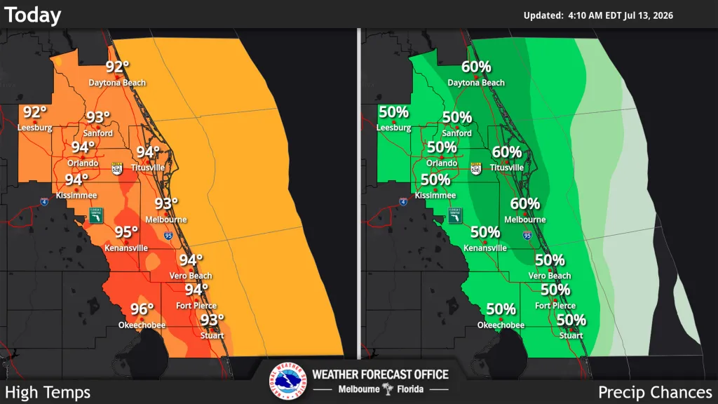
Storm chances increase across Central Florida in the afternoon, but coupled with humidity that could bring the heat index, or feels-like temperatures, to as much as 107 degrees, the National Weather Service in Melbourne stated.
Read more Miss Manners: My pregnant friend was criticized just for showing up at a party
The chance for storms ranges from 40% to 60% across east Central Florida with stronger storms capable of frequent cloud-to-ground lightning, gusty winds 40 to 50 mph, and locally heavy rainfall.
“Small hail or a brief tornado cannot be ruled out,” the NWS warned.
Regular temperatures will hit highs of the low to mid 90s with peak afternoon heat indices ranging from 102 to 107 degrees, meaning a moderate heat risk impact in most areas, but worse near the coast where a slowed sea breeze will delay relief.
Read more Orlando Sentinel 150: Monday Memory of Orlando’s ‘giant asparagus’ art
Tuesday will see near-normal rain and storm chances with the arrival of more Saharan dust limiting rain and storm chances into midweek.
“Hot, humid July temperatures will lead to afternoon heat indices between 102-107F each day. Be sure to practice heat safety,” the NWS stated.
Read more Kissimmee man’s tragic death underscores health insurance gaps