
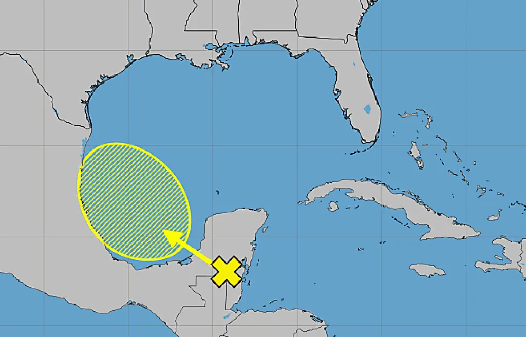
And so it begins. The National Hurricane Center began tracking this week the first system with a chance to form into the season’s initial tropical depression or storm in the Atlantic basin.
Read more Pictures: Ten10 Brewing, Orlando Sentinel partner for commemorative beer
By Thursday, chances remained slim for it to form, though. The NHC’s 8 a.m. tropical outlook states a broad area of low pressure is likely to develop over the Bay of Campeche on Friday from a tropical wave headed west that was over the Yucatan Peninsula of Mexico.
“Environmental conditions are forecast to be only marginally conducive for development before the system moves inland over eastern Mexico late Saturday or Sunday,” forecasters said.
It’s no threat to Florida.
The NHC gives it just a 10% chance to develop in the next two to seven days.
The next update is at 2 p.m. with the NHC making updates every six hours at 2 a.m., 8 a.m., 2 p.m. and 8 p.m. for its tropical outlook report.
The eastern Pacific has already been busy with three tropical storms, but so far the Atlantic basin has been quiet.
As the 2026 Atlantic hurricane season begins, NHC Director Dr. Michael Brennan shares an important message about hurricane preparedness.
Read more Talking Central Florida: DeSantis vs. Disney
Learn more at https://t.co/tW4KeGdBFb and https://t.co/smDd2LqFsl pic.twitter.com/SbmmQG8Zni
— National Hurricane Center (@NHC_Atlantic) June 1, 2026
Hurricane season officially began June 1 and runs through Nov. 30. The height of hurricane season runs from mid-August into October.
The National Oceanic and Atmospheric Administration expects this season to be below normal with the official forecast released in late May calling for 8-14 named storms, of which 3-6 would become hurricanes. Of those, 1-3 would become major hurricanes reaching Category 3 status or above.
An average season has 14 named storms, seven hurricanes and three major hurricanes.
Read more New child pornography charges for Lake Brantley student accused in ‘blood ritual’ murder plot