
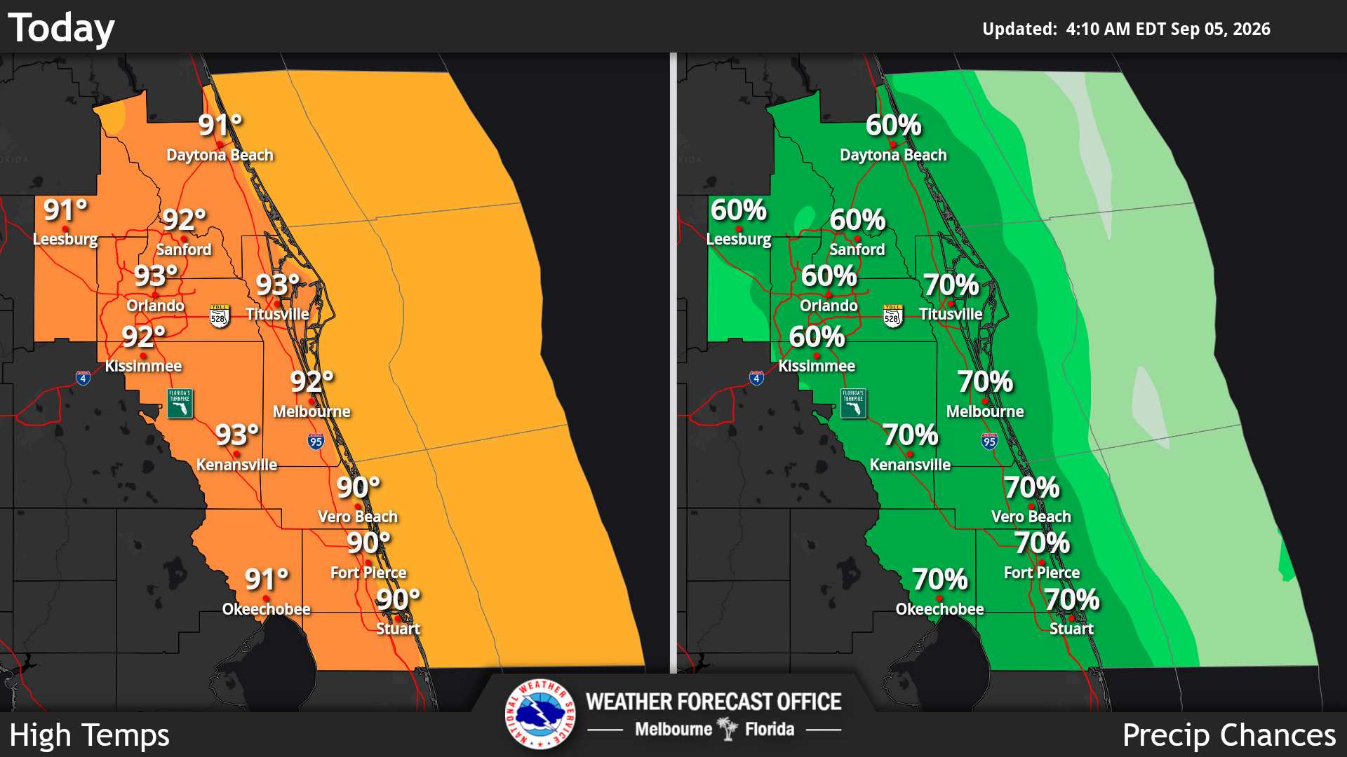
Central Floridians should plan for a hot, extremely muggy and stormy weekend. The biggest concern today will be heavy rain and minor flooding, according to the National Weather Service in Melbourne.
Read more Week 3 Football Rewind: Osceola knocks off Lake Mary; 4 teams in overtimes
Rainy weather will continue through the weekend and into early next week with frequent thunderstorms. Some storms could produce 2–4 inches of rain in a short period, especially if storms move slowly or repeatedly pass over the same area.
Thunderstorms are most likely during the afternoon and evening. Today and Sunday have roughly a 50–70% chance of storms, with activity developing inland and then moving back toward the east coast. Expect frequent lightning and locally strong wind gusts of 35–45 mph.
Read more Lake Commissioners approve rezoning for massive Wellness Way community
It will remain very hot and humid. Afternoon temperatures will generally be around 90 degrees to the mid 90s, while nighttime temperatures stay in the 70s. Heat indices could reach 100–107 degrees, although they are expected to remain below heat advisory criteria.
This pattern will continue Monday through Friday with rain chances expected to remain higher than normal and locally heavy rainfall continuing to be the primary weather threat. The most important precautions are to stay hydrated, avoid being outdoors during frequent lightning and be prepared for sudden torrential rain and localized flooding.
Read more Miss Manners: I tried to educate these dog walkers and they snubbed me