
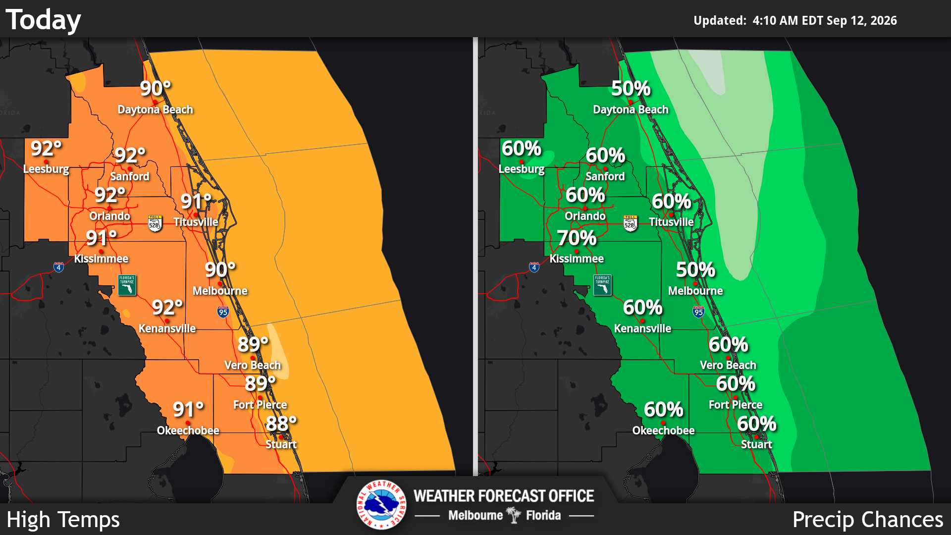
This weekend will be hot, humid and stormy across Central Florida. Scattered showers and thunderstorms are expected, especially from late morning through the afternoon and evening, according to the National Weather Service in Melbourne.
Read more A Reunion rental with basement bowling alley is yours for $12.5 million
Most temperatures will reach the upper 80s to lower 90s, while mornings remain mild in the mid-to-upper 70s. Some storms could be strong, with frequent lightning and wind gusts of 40–50 mph. Slow-moving storms may also produce very heavy rainfall, with some areas receiving 2–3 inches of rain locally.
The heat will remain an important factor. Although temperatures will be seasonably hot, high humidity could make it feel like 100–106 degrees during the hottest part of the day. These heat-index values are expected to stay below heat advisory levels, but it is still a good idea to stay hydrated, take breaks from the heat, and limit strenuous outdoor activity during the afternoon, the NWS stated.
Read more Public payments, private profits: A half-century of methadone in America
If you’re planning to visit the beach, there is a moderate risk of rip currents along Central Florida’s east coast beaches. Rip currents can be dangerous even when the ocean looks relatively calm.
Looking ahead to next week, Monday will remain hot, with highs in the low-to-mid 90s, but temperatures should gradually become closer to normal by Wednesday as onshore winds increase. Overall, the most important concerns are afternoon thunderstorms, lightning, heavy rain, extreme heat, rip currents and worsening boating conditions by midweek.
Read more Addiction in America: ‘Make recovery more accessible than the illicit drug supply’