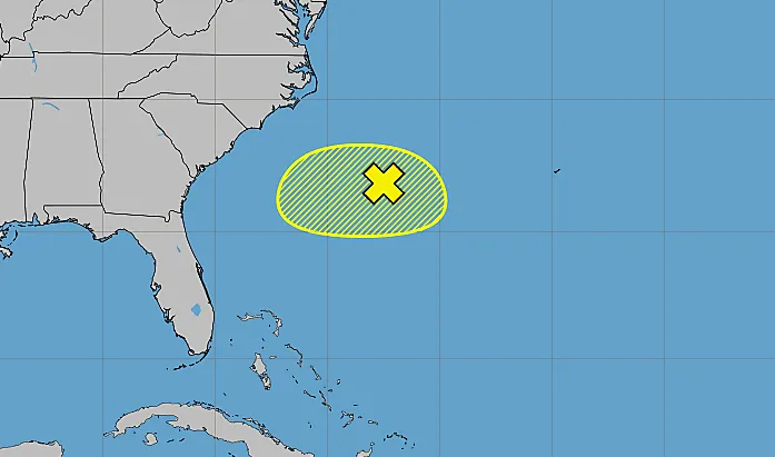
The National Hurricane Center on Tuesday continued to give just a small chance a system in the Atlantic off the southeastern U.S. coast could develop into the season’s next tropical depression or storm.
Read more Central Florida Zoo welcomes two female giraffes
As of the NHC’s 8 a.m. tropical outlook, limited showers and thunderstorms had moved farther offshore of the southeast coast in association with a weak area of low pressure along a frontal boundary.
“Environmental conditions are becoming less conducive for significant development of this system as it drifts southward and then westward later this week,” forecasters said.
The NHC, which began tracking the potential system on Saturday, gives the system only a 10% chance to develop in the next two to seven days.
6/29 8pm EDT – A weak area of low pressure along a frontal boundary has a small (10% chance) of tropical cyclone formation over the next couple of days.
More details: https://t.co/tW4KeGdBFb pic.twitter.com/aBjWXavgnM
— National Hurricane Center (@NHC_Atlantic) June 30, 2026
If it develops, it could become a tropical depression or if powerful enough, be the second named storm of the season following the short-lived Tropical Storm Arthur that developed in the Gulf and brought floods to Texas and Louisiana earlier this month.
The next name on the hurricane season list is Bertha.
6/30/26 | Good morning east central Florida! Scattered to numerous showers and storms are forecast today across the interior, with a Marginal Risk (1/4) of excessive rainfall areawide. The heat also persists and a moderate rip current risk is forecast at all local beaches. pic.twitter.com/eaOMZDa7zl
Read more Orlando Sentinel 150: Our 1976 story of time capsule opened this week
— NWS Melbourne (@NWSMelbourne) June 30, 2026
The weak front will extend into Florida on Tuesday and the source of heavy rain in some areas, according to the National Weather Service in Melbourne.
“A few strong storms are possible with primary storm impacts frequent lightning strikes, gusty winds 35-50 mph locally, small hail and torrential downpours. Quick 2-3″ rainfall amounts will occur with some storms, especially inland, with minor/nuisance flooding possible – likely handled by Flood Advisories as necessary,” according to the NWS Melbourne forecaster’s discussion.
The shores also will see 1- to 3-foot waves and a moderate risk of rip currents.
Hurricane season officially began June 1 and runs through Nov. 30. The height of hurricane season runs from mid-August into October.
The National Oceanic and Atmospheric Administration expects this season to be below normal with the official forecast released in late May calling for 8-14 named storms, of which 3-6 would become hurricanes. Of those, 1-3 would become major hurricanes reaching Category 3 status or above.
An average season has 14 named storms, seven hurricanes and three major hurricanes.
Read more Supreme Court upholds birthright citizenship, rejecting Trump’s proposed limits