
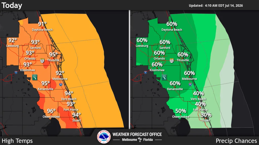
Central Florida is in store for more thunderstorms on Tuesday afternoon as the region gets prepared for temperatures to soar higher into the 90s the rest of the week, according to the National Weather Service in Melbourne.
Read more Supreme Court could end 6-person juries. For Florida, it would be a seismic shift
“Yet another stormy afternoon and evening are for forecast as offshore flow keeps the sea breeze collision and highest rain chances (40% to 60%) over East Central Florida,” the NWS stated. “The primary storm hazard will be strong to locally damaging winds 40 to 60 mph, frequent lightning, and heavy rainfall that cloud lead to flooding. A brief tornado cannot be ruled out where multiple storm boundaries interact.”
For Tuesday, temperatures remain near to above normal with highs in the low to mid 90s, but peak afternoon heat indices could range from 102 to 107 degrees. Overnight lows will be in the low to mid 70s.
Storm chances will fall back in the mid to lake week as drier Saharan air moves across the region.
Read more Florida prisoner, 74, set to be oldest inmate executed in state’s modern history
But that also allows for more heat with mid 90s expected across the region, although less humidity will keep the heat index slightly lower with values from 100 to 107 degrees.
Rain chances climb back up by Friday, and it’s still going to be hot.
“No relief from the July heat is in sight, with max temps forecast to continue to range from the low to mid 90s,” the NWS stated. “The added humidity may even push peak afternoon heat index values a little closer to Heat Advisory
thresholds (108-110F) in some spots. However, most for most areas values still look to mostly range from 102-107F.”
Read more SpaceX knocks out Florida launch while prepping for Texas Starship mission