
A powerful El Niño has taken global weather by the reins this summer.
The pattern has led to record-breaking heat, damaging floods and most notably for Floridians, a so-far blissfully quiet hurricane season.
Read more Self-described ‘witch’ goes on trial for murder in a Broward case with no body
The “Super” El Niño could become the strongest ever recorded, though it’s still in its formative stage and will continue developing over the coming months.
While the hurricane season has been quiet so far, that doesn’t mean Florida residents should let their guard down. Though El Niño clips juvenile hurricanes in the Atlantic, late-season tropical systems are more common in the Gulf of Mexico, where El Niño’s shredding power is less acute.
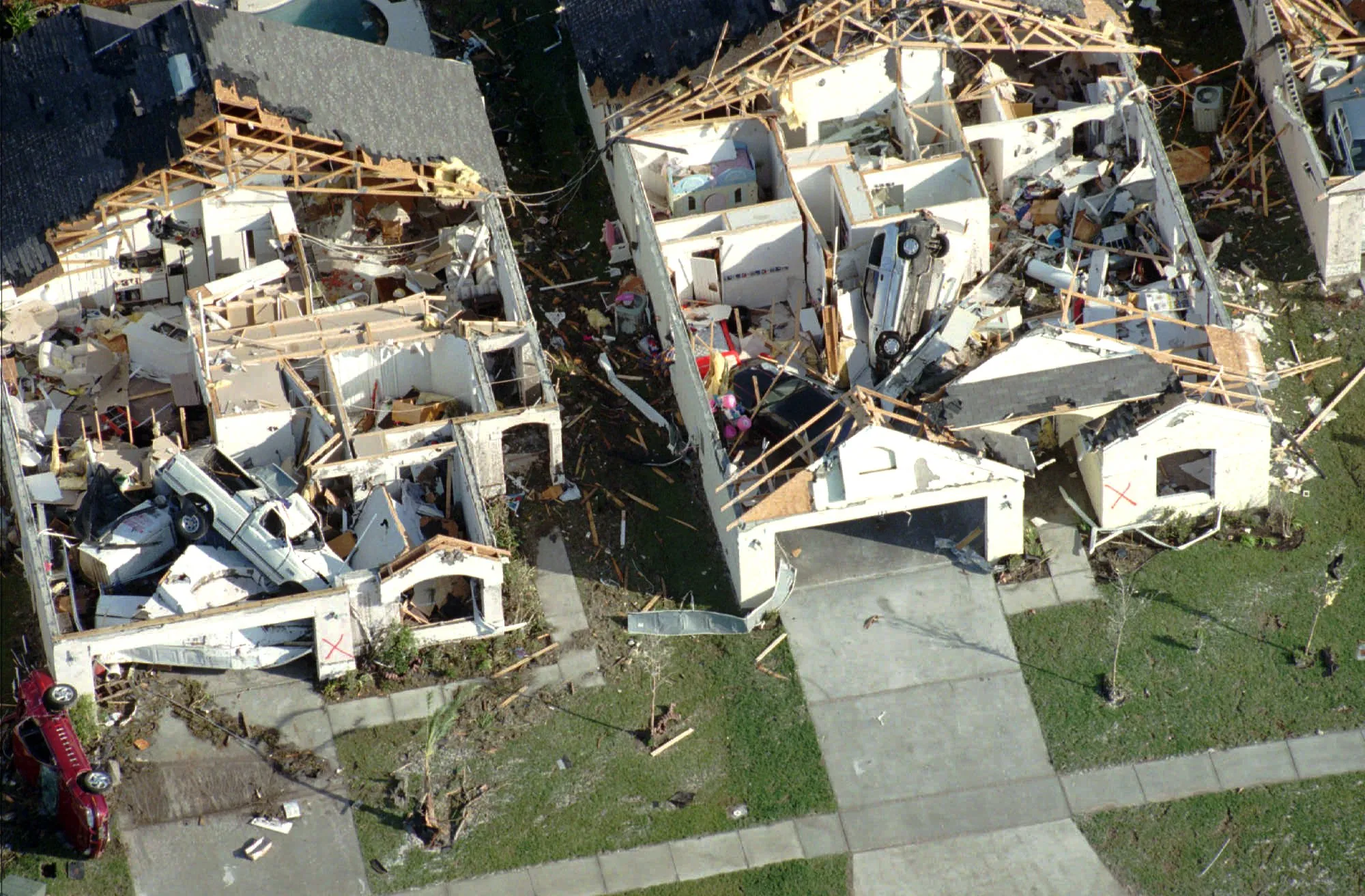
Even if the hurricane season stays muted, El Niño can mean a colder and wetter fall and winter with a greater chance of severe weather and tornadoes.
Here’s what Floridians should know as this El Niño grows more robust.
No hurricanes so far. Thank El Niño
El Niño is part of a year-to-year cycle that corresponds to changes in sea surface temperatures in the Pacific Ocean and affects weather across the globe.
El Niño’s counterpart, La Niña, is the cooler part of the cycle and typically leads to more Atlantic hurricane activity. El Niño is the warm part of the cycle, and ramps up storm-shearing winds that tamp down on the Atlantic hurricane season.
This El Niño is still considered moderate by federal climatologists, who expect it to muscle up as water temperatures in the Pacific Ocean reach more than 5 degrees warmer than normal between November and January.
This hurricane season, as El Niño has strengthened, has been the quietest in the “modern satellite era,” which began in the mid-1970s and allowed researchers to better monitor tropical cyclones, said Brian McNoldy, a senior research associate at the University of Miami.
Hurricane season’s peak was last week, and this is the first time in recorded weather history that the season has gone this long without a hurricane forming. So far, only a few tropical storms have developed.
But late season is when forecasters’ eyes turn to the Gulf of Mexico, where short-range storms can quickly gain strength over warm waters.
That could still be a concern in the waning weeks of hurricane season, McNoldy said.
“Could something pop up in the Gulf on a short fuse? Yeah, I think it could,” McNoldy said.
“That’s probably where we need to be watching.”
What can Floridians expect this winter?
So what about after hurricane season ends on Nov. 30?
Even if the hurricane season ends with a whimper, episodes of winter weather could get rough.
At the very least, El Niño winters are typically wet and cool, said Emily Powell, the state climatologist housed at Florida State University.
During El Niño years, the jet stream is typically stronger and farther south. That can lead to cold fronts and low pressure sagging into Florida, bringing a risk of stormier weather across the state.
Read more Palm Beach County meeting turns tense over Israel bonds: One arrested, several removed
Central and South Florida can expect nearly twice as many tornadoes during El Niño years compared to others, according to the National Weather Service’s Tallahassee office.
During particularly strong El Niño years in the past, an average of 20 tornados touched down across this part of the state. One week in fall 2023, six tornadoes spun up from Sarasota north to Crystal River, with one devastating a Dunedin mobile home community.
Two of the most extreme El Niño cycles in history — one in the early ‘80s, another in the late ‘90s — spawned the most significant and deadliest tornado outbreaks in Florida. Tornadoes across Central Florida killed 42 people in 1998, according to the weather service.
Whether a lot of tornadoes form or not, Florida is likely to be wet this fall and winter.
That may not be a bad thing. Florida has been in a drought since at least late 2025, when the Southwest Florida Water Management District declared a water shortage, and more rain this winter could relieve it.
Powell said Florida’s typical fall weather will kick in on schedule. The first real cold fronts reach Central Florida in November.
But cooler-than-average temperatures aren’t likely until around the end of the year.
“It’s not until December that we really see changes statewide for cooler than average temperatures,” Powell said.
Powell said model confidence becomes more solid in January for a below normal winter, and that could last until at least March.
Late season freezes could be something to watch out for, she said.
“The take home is just be prepared and keep an eye on forecasts,” Powell said. “We don’t know exactly where, when and how persistent those patterns will actually be.”
More cloud cover could mean cooler temperatures than normal, but without harsh cold snaps that brought snow to the Panhandle last year.
Jeff Berardelli, chief meteorologist for WFLA News Channel 8, said Tampa Bay can expect fronts nearly every week this winter, with some bringing severe storms.
The tornadoes those cold fronts may stir up could stay on the ground longer than usual, Berardelli said.
“This is an unprecedented El Niño, so you should expect unprecedented things,” he said.
Read more GOP Miami rep. warns Trump’s immigration crackdown could lose Latino voters