
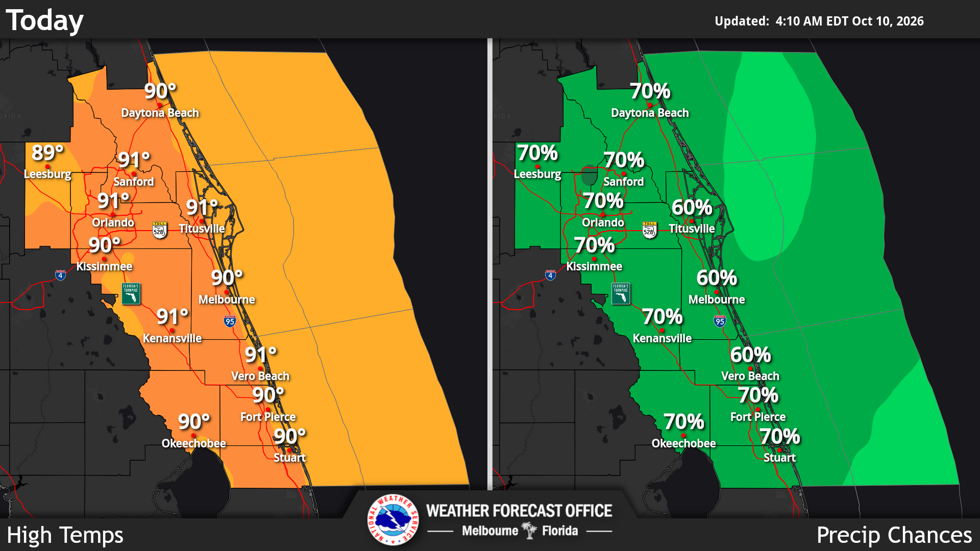
Central Florida will experience a hot, humid and stormy weekend. Scattered to numerous showers and thunderstorms are expected, with a 50% to 70% chance of rain each afternoon and evening, according to the National Weather Service in Melbourne.
Read more Guest Commentary: Amendment 3 signals a tax shift, not a tax cut
Saturday will be especially hot, with temperatures reaching the upper 80s to low 90s and heat index values between 100 and 105 degrees.
Strong thunderstorms may bring dangerous weather, including occasional lightning, wind gusts up to 50 mph and brief periods of torrential rainfall. Areas that experience repeated storms could see minor flooding.
Beach conditions are extremely dangerous today. A high risk of life-threatening rip currents is in effect for all Central Florida Atlantic beaches.
Read more UN human rights office slams racist abuse of Coco Gauff and calls for solidarity to help fight it
The weather will improve significantly starting Monday. Drier air and lower humidity will bring mostly sunny skies and several mostly rain-free days through the middle of next week.
Highs will remain in the mid-to-upper 80s with overnight lows in the mid 60s to low 70s. A few showers may return late next week.
Read more GOP incumbent Bankson faces challenge from Dem physician Fox for state House