
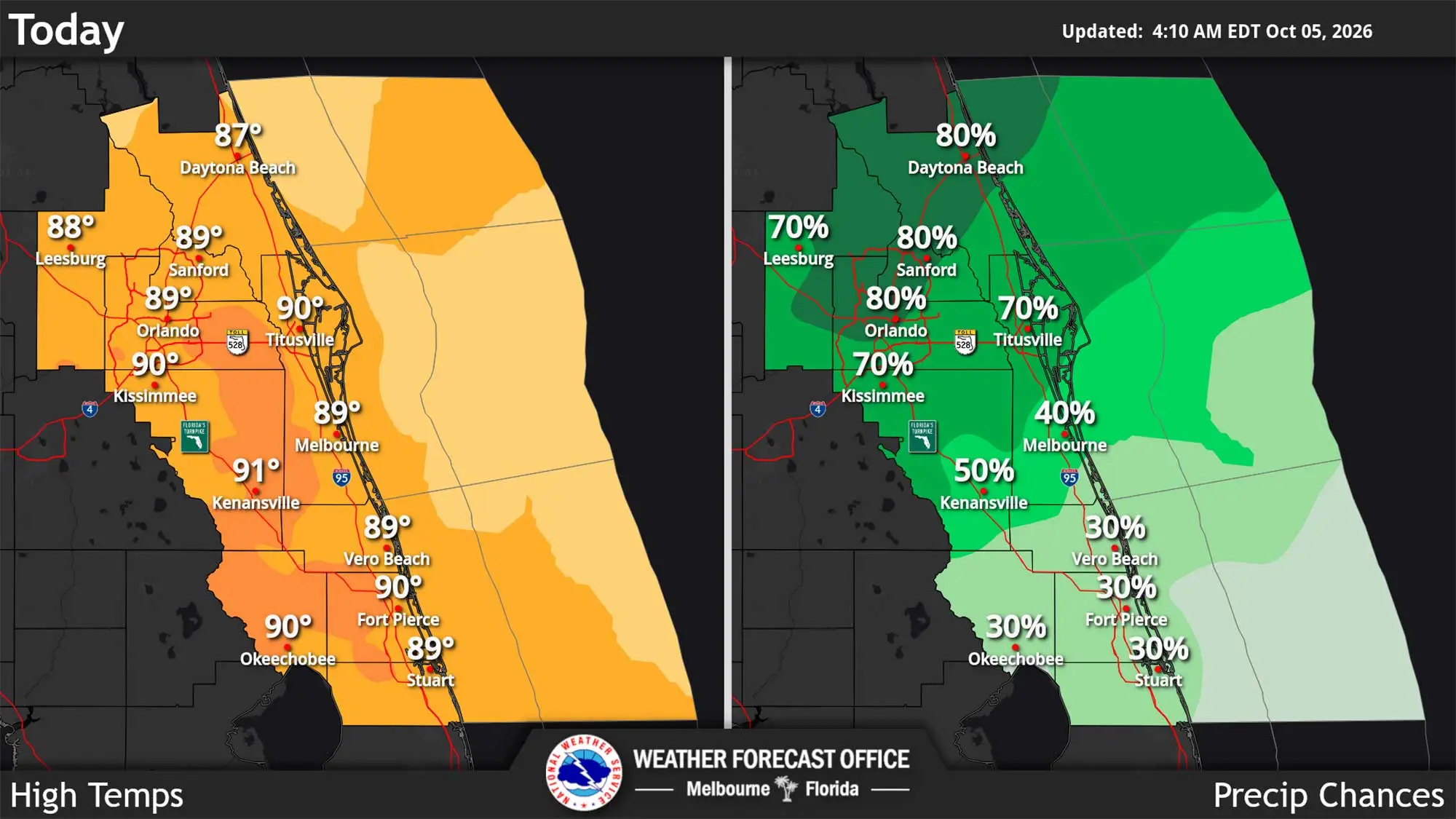
Central Florida can expect high rain chances to start the work week with similar conditions in the days ahead, according to the National Weather Service in Melbourne.
Read more Palm Beach GOP endorses candidate accused of child sex abuse
The region is under a wet and unsettled pattern expected to last through the weekend and into next week.
“Lightning storms are forecast to develop along and ahead a cold front across east Central Florida into the afternoon and evening hours,” the NWS stated. “The greatest chance for rain showers and lightning storms is between 2 p.m. and midnight with the highest chances across areas from Melbourne to Lake Kissimmee northwards.”
Some areas could get from 2 to 2.5 inches of rain, but storms won’t have as high a chance to be severe.
Temperatures are expected to climb into the high 80s on the coast and low 90s in the interior, but the heat index could climb from the mid-90s to 103 degrees.
Read more Governor candidate David Jolly offers blunt message about his rival: ‘Byron Donalds is a liar’
The cold front is expected to stall and meander between northern Florida and middle half of east Central Florida through midweek, bringing the higher chances for more rain.
“Numerous to widespread showers (60-90% chance) and lightning storms are forecast to develop each day with the highest chances generally during the afternoon and evening hours (12PM-2AM),” forecasters stated.
Afternoon highs will be in the low to upper 80s and overnight lows in the upper 60s to mid 70s.
Read more Trump says his super PAC will pay for taxpayer-funded ads that sparked backlash for glorifying him