
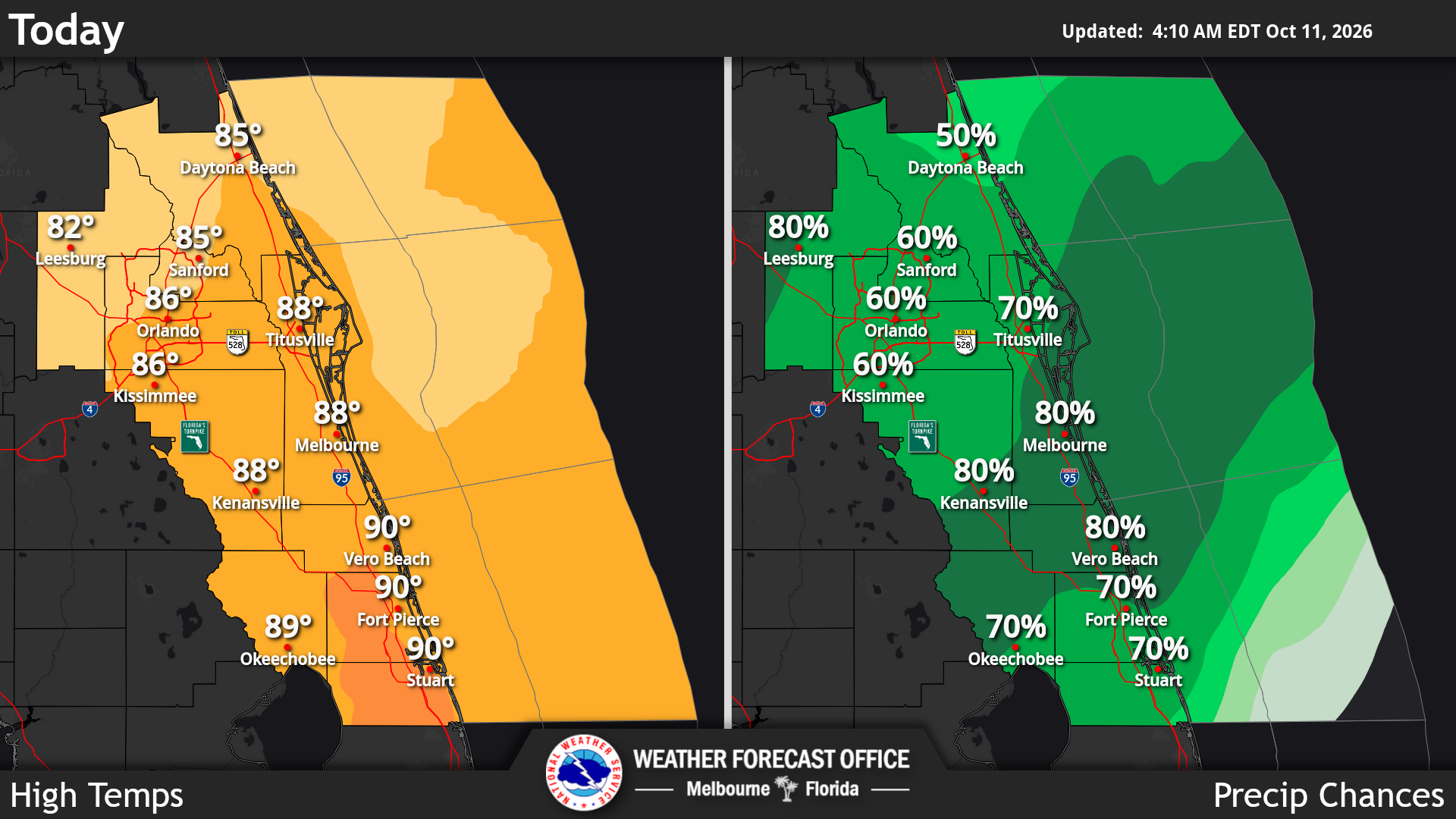
Another round of showers and storms is forecast today near and south of Orlando with a 60% to 80% chance of coverage, according to the National Weather Service in Melbourne.
Read more UCF comfortable with QB Jenkins and more | 5 things we learned from loss at No. 18 Oklahoma State
Forecasters expect a 5% to 10% chance of excessive rainfall of 3 inches or more, which could lead leading to localized flooding.
Warm, muggy conditions remain today, with peak heat indices of 100 to 105 degrees along the Treasure Coast. A cold front will deliver less humid conditions beginning Monday, forecasters said.
Forecasters warned of a moderate risk of life-threatening rip currents at Central Florida Atlantic beaches today, advising people to swim near a lifeguard and never swim alone.
Read more French-inspired Winter Park mansion approved for rare vacant lakefront lot
Looking ahead, a break from the wet weather is anticipated to begin the week.
The highs will still be warm in the mid to upper 80s under mostly sunny skies, while Monday afternoon dry air will allow dew points to drop into the mid 60s to near 70. Widespread mid to upper 60s are expected for lows Monday night, except low 70s right along the immediate coast south of Melbourne.
Forecasters expect an earlier return of sufficient moisture for a few showers during the second half of the work week as moderate onshore flow commences.
Through Thursday, these chances range from 20% to 40% generally south of Orlando before increasing to 30% to 50% area-wide on Friday. Partly sunny skies should continue, with high temps near or just above normal in the mid to upper 80s.