
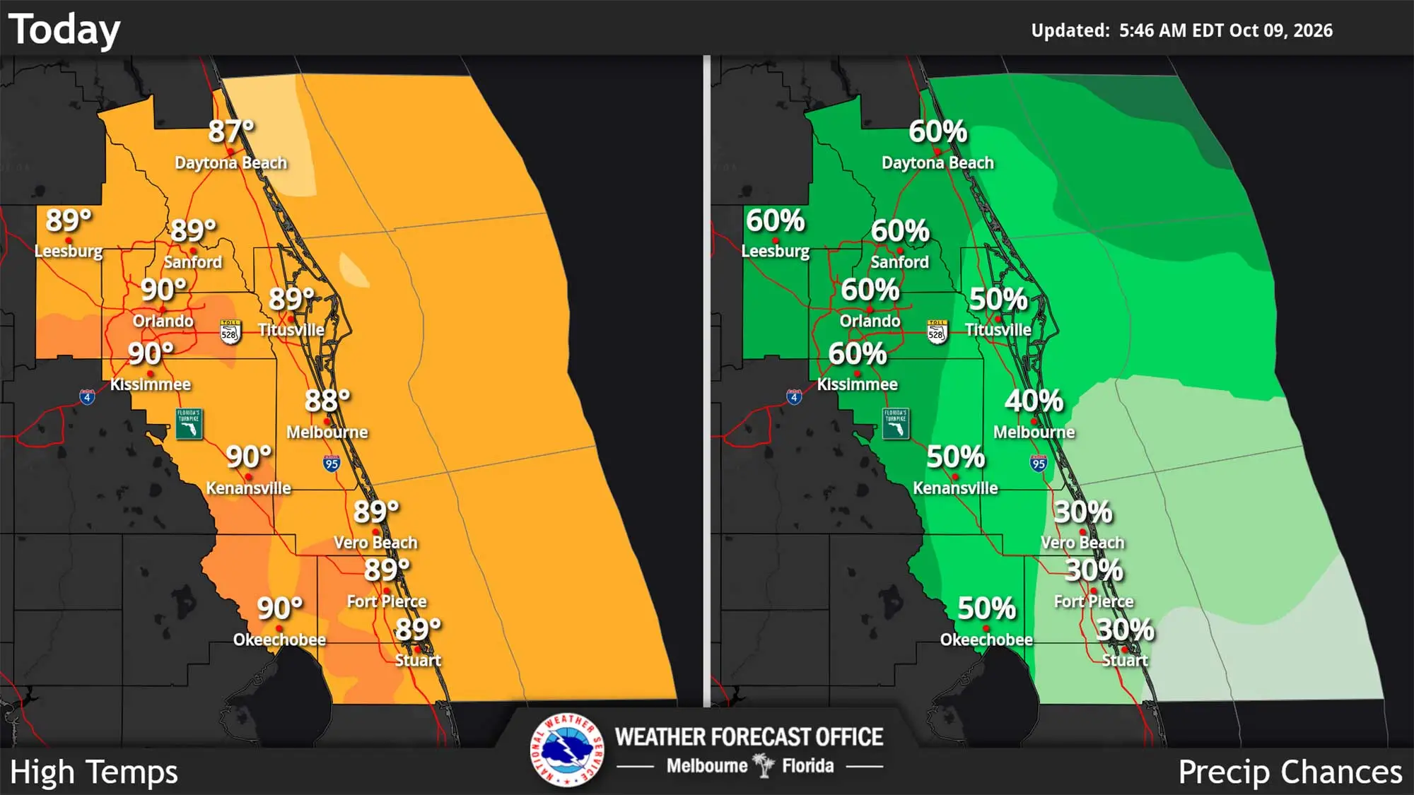
Temperatures across Central Florida will climb back to near 90 amid an unusually hot and humid day while rain chances remain above normal Friday, according to the National Weather Service in Melbourne.
Read more Orlando Sentinel 150: Friday Flashback to the Splendid China theme park
Florida’s summer that didn’t quite go away continues to feature warm, humid days through Sunday with peak heat index values going back above 100-105 degrees.
“It`s going to stay very humid. With more sunshine on the way today, the heat and humidity will make their presence felt,” forecasters said.
Meanwhile, the rainy week could continue with scattered to numerous showers and storms forecast through the weekend with each day having a 50% to 70% chance for precipitation across the region, with higher chances in the afternoon and early evening.
“The stubborn front that has focused rounds of showers and storms will finally lift north of the area,” forecasters said.
Read more Join us to talk about race and demographics in Central Florida
Rain chances remain above normal for this time of year.
“The strongest storms will be capable of producing gusty winds of 40-50 mph and occasional lightning,” the NWS stated. “Locations that see repeated storms may experience localized flooding.”
The rain does have an end in sight. With Hurricane Isaias in the Gulf moving north after a project landfall tonight, drier air is forecast for Central Florida beginning Monday.
Also of note, Central Florida’s beaches in Brevard and Volusia also feature a high risk of life-threatening rip currents on Friday.
Read more Appointed Orange commissioner Mike Crabb faces challenge from former Rep. Kamia Brown