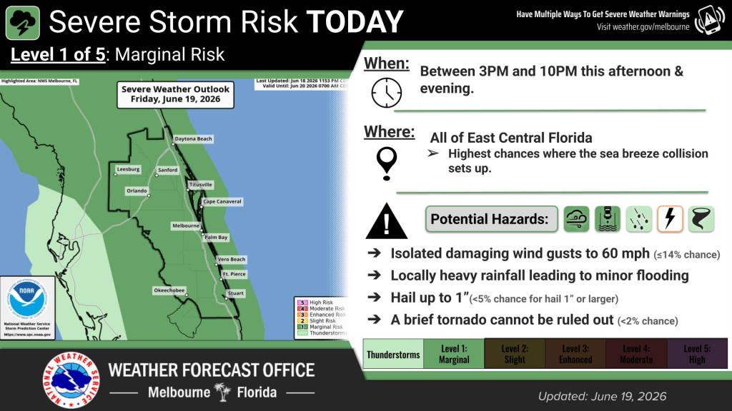
East Central Florida has a marginal risk of a severe storm.
There is a 40 percent chance of shower sand thunderstorms, mainly after 2 p.m., according to NWS Melbourne. Primary hazards include damaging wind gusts, locally heavy rainfall and frequent lightning strikes, with hail and a brief tornado or waterspout also possible.
Read more Asking Eric: We saved for our daughter’s wedding. Should we give her the money or have a party?
Friday will be sunny and hot, with temperatures near 97 degrees and heat index values as high as 107. Another heat advisory has been issued for the area from 11 a.m. to 7 p.m. Winds are blowing west to southwest at 10 mph with gusts as high as 20 mph.
There is a moderate risk of rip currents at all Central Florida Atlantic beaches, according to NWS Melbourne.
Read more A sloth exhibitor shut down in New York wants a comeback — and Florida licensed him
Looking ahead, temperatures are expected to drop a few degrees per day throughout the weekend, before warming up again next Monday.
High rain and lightning storm chances are present through the weekend, particularly on Saturday.
Read more Orlando Sentinel 150: Friday Flashback to planes on Colonial Drive